19th Century Philippines
Background
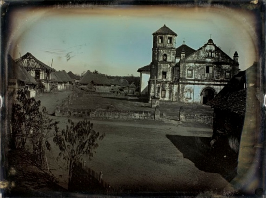
The Spanish colonisation of the Philippines was planned for Spain to have a base on the Silk Road and a platform for her expansion towards Asia. Once the Crown realised that its Asian projection was unfeasible, it decided to remain on the islands. Because of their strategic importance, Spain linked her new territory to the Mexican viceroyalty of New Spain and set up a minimum colonial administration made up of military, civil servants and religious orders. During the seventeenth and eighteenth centuries, the Philippines went from being an agrarian subsistence economy to an intermediating economy, bridging the gap between Asia, America and Europe by means of the commercial route of the galleon that joined Manila and Acapulco. The impulse of trade, entrepreneurial activity and investments in the archipelago are steadily, above all in the second half of the nineteenth century, thanks to the opening of the Panama Canal and to foreign capital. The Spanish government was incapable of adapting colonial policy to the new situation and of maintaining itself as the preferential market, preserving instead a stagnant administration opposed to autonomist reforms. Nevertheless, in contrast with the negative and unfair outlook that all colonial processes entail, the integration of the Philippines in the Spanish Empire brought about the social cohesion that favoured the construction of a national identity. In addition to the contribution of Catholicism—which exerted a great influence in Philippine society—and to the immersion of the islands in an international economy, the empire also promoted public works such as the building of lighthouses, the Manila Harbour Board and the Hydrographic Committee of the Pacific, and favoured incipient scientific development with the construction of the Manila Observatory.
In contrast with the idyllic picturesque vision of the Philippines we discover a series of much more complex photographs that show us a developing country. Many of these technical advances were captured by photographic cameras; in actual fact this is a global phenomenon.
A census drawn up in 1894 based on parish registrations shows a population of 6,414373 inhabitants, to whom we should add another million who were not registered, made up of ‘heathen’ natives, Chinese, Moros and foreigners. This same census also includes another reference, that of the Regular and Lay Clergy, comprising 2,751 members, while Military Personnel comprised 21,513 individuals, under three thousand of whom were from the Spanish peninsula and the rest were natives.59 These figures inform us of the religious and military imperialist régime, dominated by an organised Spanish minority that used all the ideological and coercive resources at its disposal.
1800s
The 1800's was a time of change for the global world order. A time of flux among different European powers. In the Philippines, the Filipinos were still under Spanish rule and resistance to it were largely ineffective owing largely to the Spaniards' policy of keeping the natives illiterate and divided along ethnic lines.
The following are snapshots of scenes in the Philippines prior to the 1896 revolution.
 |
| Spanish women and a Filipina mestiza |
 |
| Spanish bullfighting ring in Paco |
 |
| Spanish luxury in the old days |
 |
| Spanish civilians on the Manila-Dagupan line |
 |
| Old Manila map |
 |
| Spanish Dominican friars in Cagayan (Padre Damaso ?) |
The church kept a tight grip over the population using the pulpit to "brain wash" the indios into accepting the social situation. Life for the indio was indeed tough in these times. On the other hand, life for the upper class was luxurious.
 |
| A typical market scene - Batangas market |
 |
| Indio children |
 |
| A Chinese trader in the late 1800s |
The thriving Manila-Acapulco trade quickly attracted growing numbers of Chinese to Manila. The Chinese, in addition to managing trade transactions, were the source of some necessary provisions and services for the capital. The Spanish regarded them with mixed distrust and acknowledgment of their indispensable role. During the first decades of Spanish rule, the Chinese in Manila became more numerous than the Spanish, who tried to control them with residence restrictions, periodic deportations, and actual or threatened violence that sometimes degenerated into riots and massacres of Chinese during the period between 1603 and 1762.
 |
| An execution scene (executing pirates), one of the oldest picture taken in the Philippines |
A street scene in Escolta (above), the commercial area of Spanish period Manila. A view of Escolta from the Pasig river(below left)
The main commercial thoroughfare was calle Escolta in the Binondo district, which was connected to the old walled city by the Bridge of Spain. Its heyday was around the end of the nineteenth century, after the commercial and economic centre had moved from
Intramuros to the other side of the River Pasig, in the middle of that century. Other important streets were La Calzada del General Solano, where the houses of the local bourgeoisie emerged, La Calzada de Malacañang, which led to the residential palace of the Captain-General of the Philippines, La Calzada de San Sebastián and the street known as Sampaloc. Important civil buildings included the Prince Alfonso theatre in Arroceros, the Jesuit Observatory at Ermita, the prison in Bilibid and the tobacco factory at Tondo. Urban development in the nineteenth century yielded diverse and beautiful leisure spots, interesting among which were the avenues of Malecón, Sampaloc, Magallanes and the famous Luneta. These were all outside the walled city, as were the three main roads that were linked to the old city, the Bridge of Spain, the suspension bridge and the Ayala Bridge. The first of these dates from 1630 and was the first bridge to join both banks of the River Pasig. The photograph shows the stone and iron bridge, built to replace that destroyed in the 1863 earthquake, which joined paseo Magallanes with the new street in Binondo. The suspension bridge, a work of advanced technological development, was privately owned and to cross it a toll had to be paid. It joined the suburbs of Quiapo and Arroceros. Lastly, the Ayala Bridge, so named after the former Overseas Minister, was opened in 1880 and joined the districts of San Miguel and Concepción. It was made of two sections, the central section of which had supports on the island of San Andrés. Another bridge, the Misericordia Bridge, was made of iron and built using a system patented by the Eiffel company. (
See below)
 |
| Spanish guards and civilians at the Isabel gate (Intramuros). Note the tall civilian on the right |
A private picture taken in Escolta. The oldest photographic studio known in the Philippines was active in 1865 and was owned by Albert Honiss, a British photographer resident in Manila. Examples of such commercial work is this visiting cards reproduced here, an elegant portrait of the Spaniard Bartolo
Church and state were inseparably linked in carrying out Spanish policy. The state assumed administrative responsibility--funding expenditures and selecting personnel--for the new ecclesiastical establishments. Responsibility for conversion of the indigenous population to Christianity was assigned to several religious orders: the Dominicans, Franciscans, and Augustinians, known collectively as the friars-- and to the Jesuits. At the lower levels of colonial administration, the Spanish built on traditional village organization by co-opting the traditional local leaders, thereby ruling indirectly.
This system of indirect rule helped create in rural areas a Filipino upper class, referred to as the principalía or the principales (principal ones). This group had local wealth; high status and prestige; and certain privileges, such as exemption from taxes, lesser roles in the parish church, and appointment to local offices. The principalía was larger and more influential than the preconquest nobility, and it created and perpetuated an oligarchic system of local control. Among the most significant and enduring changes that occurred under Spanish rule was that the Filipino idea of communal use and ownership of land was replaced with the concept of private, individual ownership and the conferring of titles on members of the principalía.
 |
| Spanish missionaries |
Lighthouse construction
In the late 1800s, several construction projects were undertaken by the Spanish colonial government including the building of roads, bridges, lighthouses and railways.

 Another part of Escolta
 |
| Manila outskirts |
 |
| Pasig docks |
 |
| A Spanish owned factory |
 |
| Jesuit owned Manila observatory |
 Malabon
 |
| A scene in Malabon, note the tranvia tracks |
 A view of the Manila Cathedral
 |
| A Spanish tranvia in Malabon |
The first steps to create a railway network for the island of Luzon were taken in 1875 in the shape of a royal decree that established three different lines from Manila to Dugapan, to Bicol and to Batangas. Three years later, the Philippine Light Railway Company was founded and by 1889 it owned four lines that joined Santa Cruz to Tondo, Sampoloc, Intramuros and Malate. On July 31 1887 the first stone was laid on the Manila to Dagupan railway, of which there is a photograph taken by Francisco Pertierra. Images of this first line have also been conserved by E. M. Barretto’s Centre for Artistic Photography
 At the mouth of the Pasig River

 Fort Santiago

 Barrio Meisic in Tondo
 Manila Plaza scene
A classroom in Ateneo de Municipal
 |
| The expedition to the Carolines to establish Spanish sovereignity |
A picture of a Chinese mestiza and an Indio
A group picture of mestizos
A family of mestizos
Philippine Normal School
Constructed of lighthouses
The album below is a comprehensive photographic display of the different military bodies in the Philippines (Cavalry, Civil Guard, Infantry, Halberdiers, Police Force, Artillery and Engineers) that inform us of the condition of the Spanish army in the colony around the year 1885.
Various types of Spanish and Indio soldiers
The Mindanao problem
Not all of the Philippines were under effective Spanish control. Mindanao, was particularly a problem. Mindanao and the Jolo archipelago particularly were very conflictive zones because of the fierce resistance of these communities, which did not only resist conversion to Christianity, but also attempted to convert the inhabitants of the mountains and inland areas of Mindanao island to Islam. This, together with their continuous attacks on the coast of Visayas, and even Luzon, which they sacked, while killing and enslaving the people, made the Moro problem a constant source of conflict that Spain did not manage to control until the end of its colonial presence. From the sixteenth century onwards, fortifications were built that made Zamboanga the main Spanish military centre in the southern Philippines and in the second half of the nineteenth century Spain began the military enforcement of its rights over Mindanao and Jolo, stepped up military campaigns and built more fortifications.
The National Library in Madrid preserves an album of photographs entitled Recuerdos de Mindanao (Memories of Mindanao) that illustrates the establishment of missions (in this case Jesuit) in the island’s five districts: Zamboanga, Cottabato, Davao, Surigao and the Jolo archipelago. The images show how the work of religious indoctrination is associated with the establishment of a colonial social and administrative structure: photographs of missionaries and churches are alternated with portraits of local governors and labourers, with a backdrop of Spanish military detachments. These initial settlements enabled the missions and the colonial authorities to gradually penetrate inland and extend their influence, even though their efforts were constantly hindered by Moro incursions. The last quarter of the century was especially conflictive, as proven by the campaigns by General Malcampo in 1876 and by the Governor of the Philippines, Don Fernando Primo de Rivera, in 1882. In 1891, Governor Don Valeriano Weyler y Nicolau began the systematic military occupation and fortification of the main strategic sites. The provinces of Surigao, Misamis, Dapitan and Davao were thus incorporated into the Spanish administration, although the area enclosed by the Iliana and Iligan bays, which included River Grande in Mindanao, put up resistance and represented an ongoing source of instability and conflict. Fortification was therefore intensified in this zone and the capital was moved from Zamboanga to Cotabato, a transfer prompted by the area’s remarkable strategic value in the region


 |
Tobacco harvesting in Cagayan valley
** Updates
Newly discovered pictures tucked away in a cabinet at the 7th floor of the Hispanic Society of America, discovered in 2007 ar shown here. It included 18 rare daguerreotypes of Manila from the 1840s, possibly the oldest photographic record of the Philippines ever discovered.
At that time, Casella and Herrera were both Andrew W. Mellon Fellows from the Advanced Residency Program in Photograph Conservation (ARP). Their original plan was to rummage HSA’s photo collection and preserve what’s left. Things turned into a different direction when they found the Manila daguerreotypes inside a cardboard box.

Discovery of Manila daguerreotypes in their storage box. Photo Credit: Rosina Herrera/George Eastman House.
Composed of 13 whole plates and 5 half-plates, the photos show incredibly preserved views of Manila, Marikina and Laguna never seen before by the public. Aware of the very nature of these early photographs, they soon embarked on a painstaking project to prevent the artifacts from suffering permanent damage.
To accomplish the mission, they sought the help of the oldest museum dedicated to photography–the George Eastman House. The latter’s Photograph Conservation Department worked closely with different conservation scientists, putting all the work for 18 straight months just to ensure the housings and the photos themselves would be in tiptop shape.
|


 A street scene in Escolta (above), the commercial area of Spanish period Manila. A view of Escolta from the Pasig river(below left)
 A private picture taken in Escolta. The oldest photographic studio known in the Philippines was active in 1865 and was owned by Albert Honiss, a British photographer resident in Manila. Examples of such commercial work is this visiting cards reproduced here, an elegant portrait of the Spaniard Bartolo


Thanks for posting. Great find. Lovely pictures. Where did you get this? Can I have a clear or large JPEG copy of the "soldier's pictures"?
ReplyDeleteLorenzo Alcazar y Del Mar
Taga-Panchong
Sure, just send me your email add
ReplyDeleteWhoah! Very impressive. Helps me understand more and appreciate our history because of your factual presentation of our history and your very rich and rare to find illustrations. Maraming maraming salamat for sharing. Mabuhay tayo!
ReplyDeletePerfectly wonderful! Great pictures you have and factual information too.Whoever posted these..thank you so much.I'm coming up with a book and I have this site as one of my sources.More power to you!
ReplyDeleteAmazing! Totally a blast from the past!! Thank you for sharing these historical treasures to all of us. Mabuhay ka and God bless you!
ReplyDeleteBtw, can I download some for my video project? Thank you
awesome job you here man.
ReplyDeleteThanks! it helped me in my project in HeKaSi :D
ReplyDeleteHi. Great historical photos! :) Such a big help. Can I have clear jpeg copy of some photos? Definitely, ill mention your site as one of the sources. Maraming salamat!
ReplyDeletevery good.:)
ReplyDeleteExcellent! May I just ask as to where you get those images. They're very rare! Are they copyrighted or now in public domain? Thanks.
ReplyDeleteSir Good day. May I know where you got those images? It would be a big help for our thesis if we could have your images. Thank You!
ReplyDeleteGreat summary of the history and great photos, too. Thank you.
ReplyDeletedo you have pictures and story of the Rizals family during spanish period? Please I really need it. If you have, can I have a copy? Thankyou!
ReplyDeleteThis comment has been removed by a blog administrator.
ReplyDeleteHello! I would like to kindly ask for your permission to use this for educational purposes. Thank you very much!
ReplyDelete